Category:Den Hool
Jump to navigation
Jump to search
| Object location | | View all coordinates using: OpenStreetMap |
|---|
human settlement in the Netherlands  | |||||
| Upload media | |||||
| Instance of | |||||
|---|---|---|---|---|---|
| Location | Coevorden, Drenthe, Netherlands | ||||
 | |||||
Media in category "Den Hool"
The following 8 files are in this category, out of 8 total.
-
 Nr.7, aanzicht - Den Hool - 20115525 - RCE.jpg 1,200 × 807; 245 KB
-
 Nr.7, aanzicht - Den Hool - 20115526 - RCE.jpg 1,200 × 813; 322 KB
-
 Nr.7, aanzicht - Den Hool - 20115527 - RCE.jpg 1,200 × 807; 315 KB
-
 Nr.8, aanzicht - Den Hool - 20115528 - RCE.jpg 1,200 × 812; 288 KB
-
 Nr.8, aanzicht - Den Hool - 20115529 - RCE.jpg 1,200 × 814; 240 KB
-
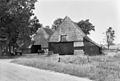
 Overzicht - Den Hool - 20115522 - RCE.jpg 1,200 × 806; 278 KB
-
 Overzicht - Den Hool - 20115523 - RCE.jpg 1,200 × 800; 278 KB
-
 Overzicht - Den Hool - 20115524 - RCE.jpg 1,200 × 812; 267 KB


